Integrated Flood Analysis System (IFAS)
Flood Forecasting System Using Global Satellite Rainfall

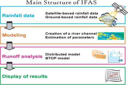
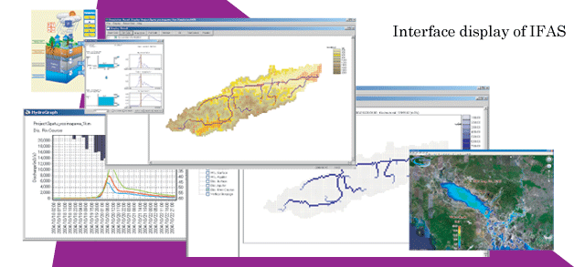
ICHARM has developed a concise flood-runoff analysis system as a toolkit for more effective and efficient flood forecasting in developing countries. This system is called "Integrated Flood Analysis System (IFAS)". IFAS provides interfaces to input not only satellite-based but ground-based rainfall data, as well as GIS functions to create river channel network and to estimate parameters of a default runoff analysis engine (PWRI distributed hydrogical model) and interfaces to display output results. ICHARM has been conducting training seminars for users to utilize IFAS and to do a co-operative study with local governments, organizations, etc. ICHARM hopes that IFAS will be widely used as a basic tool for preparing flood forecasting and warning systems in insufficiently gauged basins.
 |
Win 7, Win 8, Win 10: 32bit, 64bit |
update:
IFAS ver.2.0 (20 April 2017)
| NEW! | |
 |
Win 10: 32bit, 64bit |
 |
Win 10: 32bit, 64bit |
IFAS Calibrator is a tool of parameter optimization for IFAS
update:
IFAS Calibrator ver.2.0 (4 March 2019)
IFAS Calibrator ver.1.0 (6 December 2017)